The first open-access dataset from the ForestCO2 project has been published on the Zenodo platform. It contains results from in-situ measurements conducted at the Faculty of Forestry’s experimental site on Goč Mountain. This dataset is essential for developing and validating methodologies for forest biomass estimation and carbon credit verification using a combination of satellite and ground-based data.
The dataset includes:
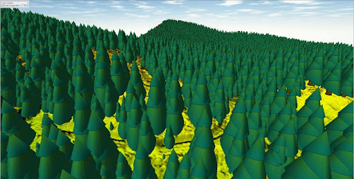
- LiDAR point clouds with an average density of 800 points/m², collected using a DJI Matrice 350 RTK drone equipped with a Zenmuse L2 sensor;
- Digital Terrain Models (DTM) and Canopy Height Models (CHM) at 1-meter and 20-centimeter resolutions, created using lidR and Global Mapper software;
- Soil spectral scans (NIR 1350–2500 nm) collected with a NeoSpectra handheld scanner, with six scans per sample;
- Laboratory soil analyses from 200 samples, including humus content and pH values;
- Tree inventory with over 31,000 individually classified tree features extracted from LiDAR point clouds.
This dataset represents a major outcome of the ForestCO2 project, which aims to develop methodologies for carbon credit verification in forestry using cutting-edge EO technologies and field measurements. The data is openly available and can be used for scientific research, algorithm validation, and development of AI models for forest ecosystem monitoring.
🔗 Access the dataset on Zenodo:
https://zenodo.org/record/14555118