Conference paper presented at SYMOPIS2024

Project team member Slobodan Jelić presented the paper “MILP for Integrated Berth Allocation and Crane Operations Scheduling in Container Terminals,” co-authored with Tatjana Davidović and Nataša Kovač, at the 51st International Symposium on Operational Research (SYMOPIS2024). The symposium was held from September 16–19, 2024, in Tara, Serbia.
Conference paper presented at ICME2024
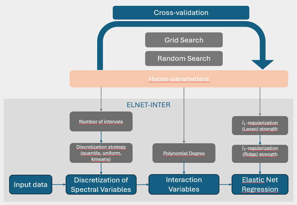
Project team members Vesna Šešum-Čavić and Slobodan Jelić presented their position paper, “An Intelligent Method for Hyperparameter Optimization in Deep Learning Models for Soil Organic Carbon Estimation from Spectral Measurements” at the 2nd International Conference on Mathematical Modelling in Mechanics and Engineering (ICME2024). The conference took place from September 12–14, 2024, at the Mathematical Institute […]
Paper published in a prestigious scientific journal
Our team member Marko Kazimirović is one of the authors of the paper “Identifying drivers of non-stationary climate-growth relationships of European beech” published in the Science of the Total Environment journal, Volume 937, 10 August 2024, 173321. https://doi.org/10.1016/j.scitotenv.2024.173321
Conference paper presented and published in the book chapter of Lecture Notes in Computer Science series
Our team member Slobodan Jelić has co-authored a paper titled “VNS-Based Matheuristic Approach to Group Steiner Tree with Problem-Specific Node Release Strategy” presented at Metaheuristics International Conference (MIC 2024) 4-7 June in Lorient, France, and published in Lecture Notes in Computer Science, vol 14753. https://doi.org/10.1007/978-3-031-62912-9_32
Paper presented at The Third Serbian International Conference on Applied Artificial Intelligence (SICAAI)
Our team member Ognjen Antonijević presented a paper from several team members titled “COMPARING DIFFERENT APPROACHES FOR MODELLING SOIL PROPERTIES FROM NEAR INFRARED SPECTROSCOPY DATA.” at The Third Serbian International Conference on Applied Artificial Intelligence (SICAAI) in Kragujevac, Serbia, held of May 23rd and 24th 2024.
ForestCO2 at the Novi Sad Agricultural Fair
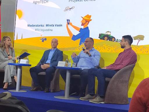
Project coordinator speaks about artificial intelligence in agriculture At the 91st International Agricultural Fair in Novi Sad, held in May 2024, one of the central panel discussions was dedicated to the topic “Artificial Intelligence in Agriculture.” Among the panelists was Milan Kilibarda, the coordinator of the ForestCO2 project, who spoke about the potential of AI […]
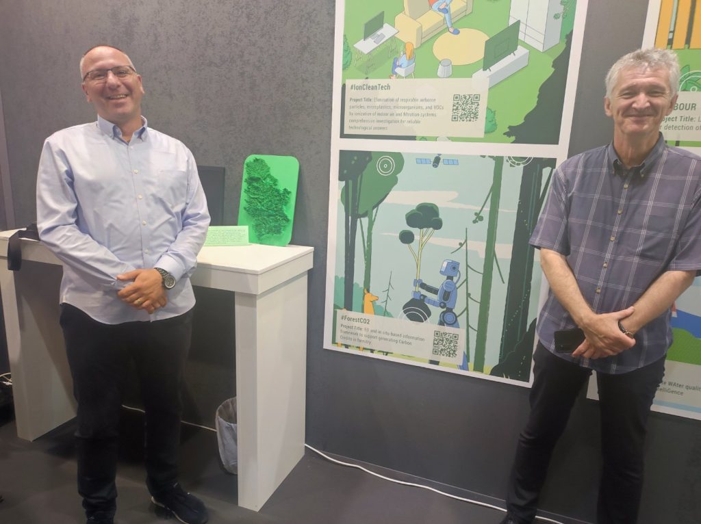
ForestCO2 at the International Fair of Techniques and Technical Achievements
The canopy height data for Serbia produced for 2020. based on the paper by Lang et al. (2022). “Global canopy height regression and uncertainty estimation from GEDI LIDAR waveforms with deep ensembles.” combines GEDI LIDAR data and Sentinel-2 imagery using advanced deep learning techniques. This data is a key predictor for biomass estimation and captured […]
Global map of tree canopy height
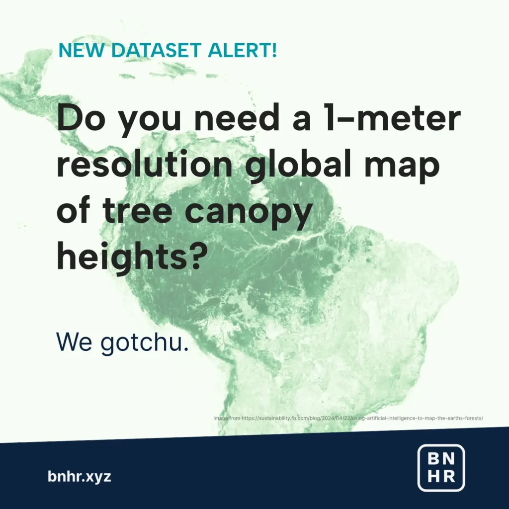
NEW DATASET ALERT! Do you need a 1-meter resolution global map of tree canopy heights? We gotchu. What is it?Meta and World Resources Institute has released a global map of tree canopy height at 1-meter resolution allowing for the possibility of detecting individual trees at a global scale. How was it made?Using AI models (i.e. […]
Using Artificial Intelligence to Map the Earth’s Forests
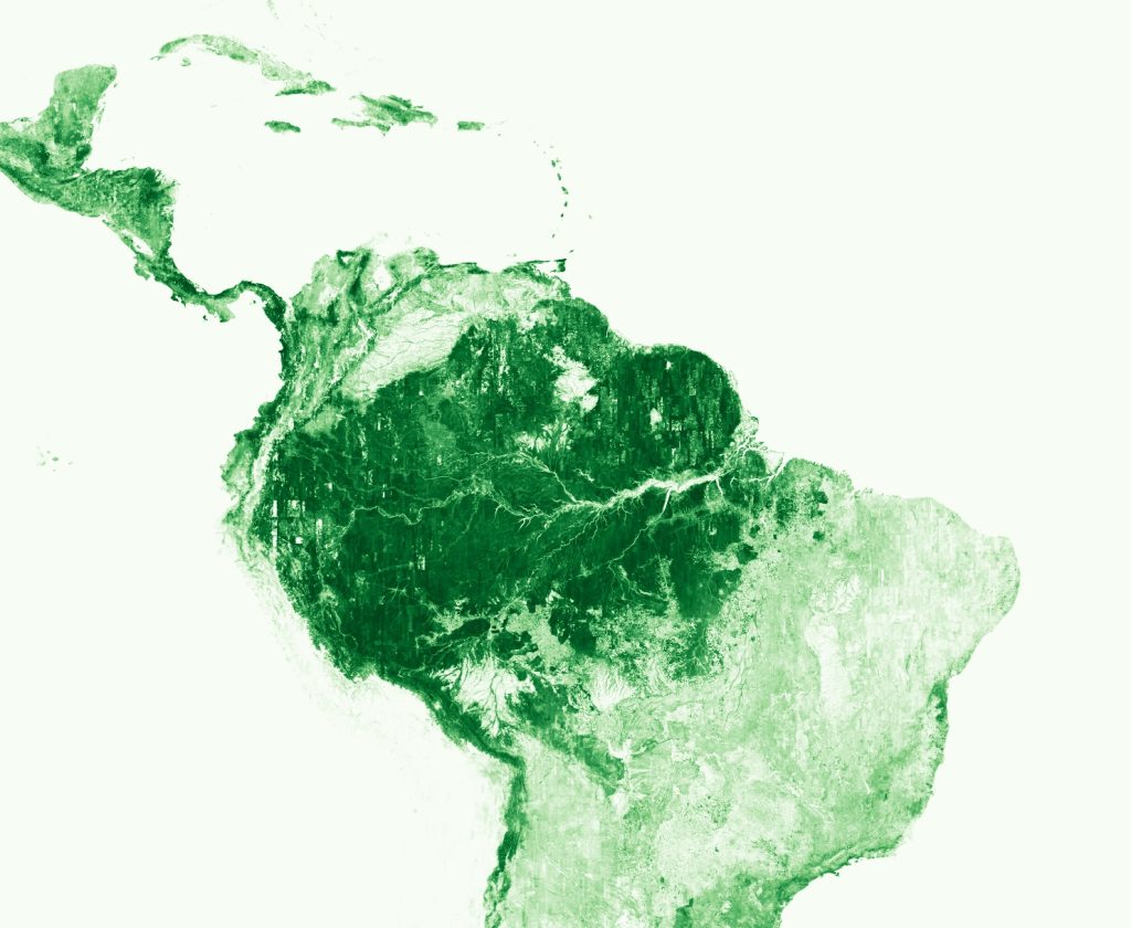
Today, Meta and World Resources Institute are launching a global map of tree canopy height at a 1-meter resolution, allowing the detection of single trees at a global scale. In an effort to advance open source forest monitoring, all canopy height data and artificial intelligence models are free and publicly available. Read more here.
MeteoEurope1km Europe
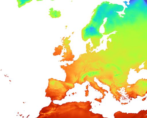
Aleksandar Sekulić, Milan Kilibarda, and Petar Bursać presented the MeteoEurope1km dataset at the EMS Annual Meeting, Bratislava, Slovakia, September 6, 2023. Covering Europe at an 1 km spatial resolution for the period 1991–2020, the MeteoEurope1km gridded dataset utilizes Spatio-temporal Regression Kriging (STRK) for accurate interpolation of daily temperatures (maximum, minimum and mean), total precipitation and […]