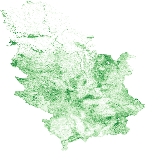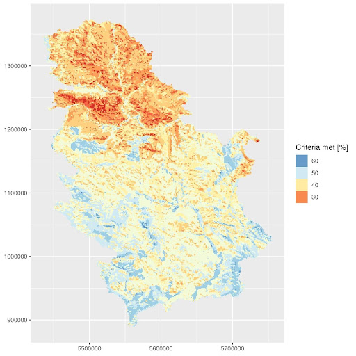
As part of the ForestCO2 project, a new open-access dataset has been published, presenting the afforestation potential areas across Serbia based on ecological and land suitability criteria derived from scientific literature. The analysis covers several tree species relevant to forest ecosystems in Serbia.
The following species were included in the study:
- Pinus nigra
- Pinus sylvestris
- Picea abies
- Quercus petraea
- Quercus robur
- Populus spp.
Methodology:
Each site was evaluated using land index criteria and ranked as follows:
- S1 (highly suitable, score 100–75) → 2 points
- S2 (moderately suitable, score 75–50) → 1 point
- N (not suitable, score <50) → 0 points
All scores were summed and expressed as the percentage of total criteria met for each location, resulting in a spatial map showing afforestation suitability in percent [%].
The dataset includes:
- .tif raster maps showing suitability percentages for each species
- .jpeg final map illustration
- species.zip – all input raster criteria files used for scoring
- species.R – the R script used to calculate afforestation potential
- data.zip – spatial layers used in the analysis
- osm_nominatim.zip – administrative boundaries of Serbia
This dataset enables strategic planning of afforestation activities in line with local soil and climate conditions, and is a significant result of the ForestCO2 project, which focuses on the role of forests in carbon sequestration and climate change mitigation.
🔗 Access the dataset on Zenodo:
https://zenodo.org/records/15202778